+1 805 664 0090

Request DemoFree Trial

Field Data Collection App Saves Compliance Project

Anita Henry 0 Comments

Wildnote’s field data collection app just won kudos for keeping a project intact on a California military base. The agency was all set to begin structural repairs to buildings and infrastructure damaged during an earthquake in 2019.The project was permitted and ready to go when it became clear that the nearby town lacked the facilities to house and feed the expected work crews. They needed a “company town,” and they would have to build that too. Everything came to a halt. While the military did have a piece of property suitable for the buildings, it required a complex archaeological cultural resource management (CRM) site assessment before they could begin.

Efficient Field Data Collection App Beats the Clock

Chris Webster of DIGTECH specializes in using digital technologies for archaeological consulting. Tasked with the fieldwork for the fast-tracked construction project, Chris quickly assembled a 4-person crew to survey the 1200-acre site. He also put Wildnote technology to work to speed up documenting the archaeological finds, creating site records and producing photo sheets.

Behind schedule from the start, the pressure was on to get the additional work done. And because it was an added unanticipated expense, the pressure to keep costs down were immense. Chris knew Wildnote could beat the clock and meet the budget.

field data collection app, photo management, cultural resource management, California DPR form

Wildnote really made the project possible. It was such a tight budget and using Wildnote makes it so easy. We cut way down on the time spent producing the complex California DPR Site Records.

cols-image

Swamp School class engaged in field training

The Swamp School

Based in Angier, North Carolina, the Swamp School offers post-secondary/college classes and webinars in wetland assessment, delineation and design, and other topics relating to the management of wetlands. The classes are designed to help environmental professionals enhance their skills and expand their business. Wildnote will be included in all of the Swamp School’s wetland delineation courses, whether offered in the classroom, online or on-demand sessions.

Automated Forms with Professional Wetland Training

The Swamp School has the ability to provide the wetland and IT technical support that students need to successfully use technology to collect data and report on wetland delineations. Marc pointed out that many of the issues with the wetland delineation data collection software products arise not from an inability to use the software but from a fundamental misunderstanding of what data needs to be collected, how, and why. By combining the wetland training with the software training, students will seamlessly integrate digital technology into their delineation projects. The newly-formed partnership was immediately put to use.

testimonial-img

Senior PWS and Swamp School Founder, Marc Seelinger, is excited about the changes ahead.

“The Swamp School is committed to providing a cutting-edge education for modern wetland scientists, who expect technology solutions to better their work. Wildnote elevates our curriculum, making the Swamp School the only wetland training program in the U.S. to offer a mobile technology component. We look forward to working with Wildnote to help our students perform more accurate and reliable delineations and to advance the state of the art in wetland evaluation technology.”

- Marc Seelinger

crm-survey-forms-mobile-300x600
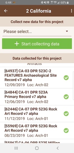
Checkboxes confirm surveys are synced from the field to office

Mobile App Keeps Data Organized

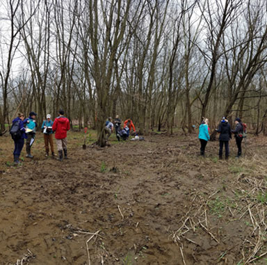
Armed with their mobile devices, crew members began the 8-day survey, requiring them to walk about 10 miles each day. During a first pass, they entered lat/long coordinates for each site in Wildnote’s mobile field data collection app.

Once this initial site data was synced from mobile devices to the web app, they were able to regroup and easily assess the full scope of the survey. Knowing how many sites required documenting and their exact locations, allowed the 4-member crew to systematically divide the workload. Additionally, the saved coordinates enabled them to confidently and efficiently relocate each site to begin the more detailed survey.

The team recorded 14 archaeological sites, including more than 20 roads found on historical topographic maps and a further 74 isolated finds.

Integrated Photo Management

The survey crew also submitted 117 photographs using Wildnote’s automatic photo management feature. With this integrated system, photos are attached to each survey, and metadata and captions are attached to each photo, saving hours of frustrating work. It also supports printing to 2-photo or 4-photo sheets, exactly as required by specifications. According to Chris, capturing so much photo data quickly was key to success.

When the State began issuing “shelter in place” orders, we had to really kick it into high gear to get the fieldwork done.

crm-primary-record-mobile-300x600
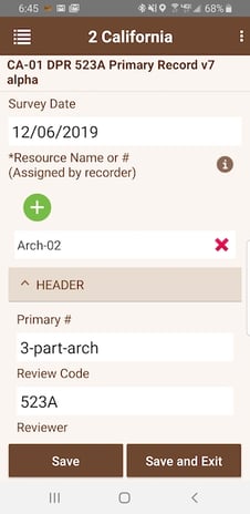
Primary record, Wildnote mobile app survey

Custom Surveys and Accessible GIS Mapping Data

For this project the fieldwork progress report had an exceedingly short 3-day turnaround. Chris explained how using Wildnote helped the contractor meet the critical deadline.


"I used the Field Notes form that I designed, and another survey form, to track our progress. There was a lot of data! It's impossible to transmit and organize data quickly when it's buried in a stack of papers. Unwieldy digital formats are just as bad. We couldn't have just emailed or used Dropbox and got it done. With Wildnote, the project manager can just log in and instantly access everything she needs right there. She got the report out within the three days instead of the usual 2-3 weeks."


Accessible Data for GIS Mapping Win

With the fieldwork complete, Chris’s team handed the data off to the primary contractor. Typically, survey data is collected on paper, painstakingly transcribed into company software for post processing.

However, by this point—exacerbating the already-tight timeline—shelter-in-place orders had been issued due to COVID-19. Staff designated for the next phase of work were now at home, self-isolating. And without Wildnote, they would have also been isolated from the data, as security policy prohibits home access to agency computers. Ordinarily, the collected field data would have been trapped at the office, but with Wildnote, the data was stored in the cloud. The team could continue working remotely. This was particularly important for the GIS department, which was able to carry on independently and add all required maps to the site records.

Photo Management Dropbox Integration

For logistical reasons, the team member tasked with photo quality assurance needed to remain working on site. The challenge she faced was in finding an approved way to upload the photos to the government server. Conveniently, Wildnote has an interface for downloading photos in bulk to Dropbox. As the government agency has a secure transfer system from Dropbox to their server, this integration allowed the photo quality assurance to continue. Throughout this process, the photos remain connected to the data for automatic reporting output.

rock-art-archaeology-site-record-600x300

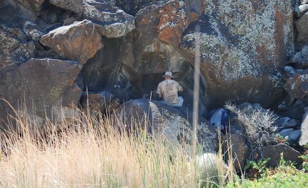
California Rock Art Foundation site observation

An expert on Chris Webster’s team, Dr Alan Garfinkle Gold is also a champion of moving archaeology into the digital age. Dr. Gold believes that due to the urgency of this cultural resource management project and the timing of the COVID-19 pandemic, conventional manual data collection methods would have failed.

He summed up the benefits of using Wildnote for this archeological project:

"We had to turn on a dime and there’s no other way to do that unless you use Wildnote. There are other workarounds out there, but none of them offer the comprehensive integrated solutions that Wildnote performs."

image1

The Wildnote process integrates and streamlines data from the field to final report

Choosing Wildnote for a Wetland Technology Partner

Seelinger spent years looking for the right technology to integrate into the curriculum. He said he chose Wildnote because it is a complete platform that supports the entire process of wetland data collection, management, and reporting.


testimonial-img

Senior PWS and Swamp School Founder, Marc Seelinger, is excited about the changes ahead.

“The Swamp School is committed to providing a cutting-edge education for modern wetland scientists, who expect technology solutions to better their work. Wildnote elevates our curriculum, making the Swamp School the only wetland training program in the U.S. to offer a mobile technology component. We look forward to working with Wildnote to help our students perform more accurate and reliable delineations and to advance the state of the art in wetland evaluation technology.”

- Marc Seelinger

How might your team benefit from a mobile field data collection and reporting system that empowers secure remote-workflow capabilities?