Emergency-response fire services are integrating mobile data collection and cloud-based software to improve both routine monitoring tasks and disaster response. Key goals are the efficiency of field data collection, consistency and accuracy in reporting, and the ability to turn raw data into meaningful, actionable information. When it comes to fire-risk assessment, accurate and timely data is paramount in saving lives, mitigating environmental damage and protecting property.
“There is high value in using smart devices for data collection. If that can happen in conjunction with a spatial component like visual mapping, efficient records management (accessible data, easy report generation) and a really good user interface – that’s the holy grail.” – Rob Hazard, Battalion Chief
GIS Mapping and Mobile Data Collection
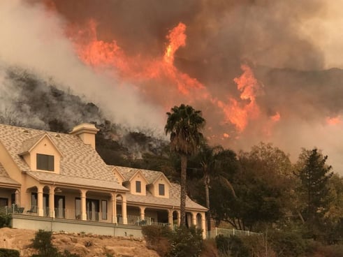
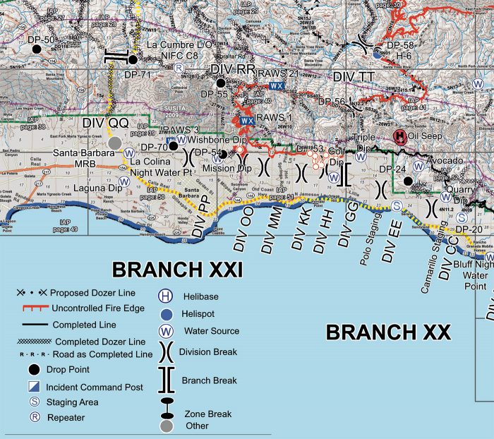
Mapping data is a critical component when fighting wildland fires, “GIS technology has been the most transformational, ” says Rob Hazard, Santa Barbara County Fire Battalion Chief. During an active fire emergency, data can be collected and sent to incident command to create real-time maps. “During post-fire field assessments, you save time when you map data points, because you can do a quick spatial view to check to see if you missed anything.”
Hazard estimates electronic data collection halves the time it takes to manually enter handwritten notes into a system, manage photos, and generate a report. He maintains that the current challenge in choosing firefighting software is that mapping software tends to have limited survey features, while specialist survey programs tend to have insufficient mapping functionality. It’s pivotal, however, that these two components easily interface with one another.
During post-fire field assessments, you save time when you map data points, because you can do a quick spatial view to check to see if you missed anything.
Custom Surveys and Actionable Reports
“The smart phone apps that gather data are critical now” said Rob Lewin, director of the Santa Barbara, California Office of Emergency Management (OEM). Before this position, Lewin had 37 years with Cal Fire under his belt, including five years as Chief, and it was clear to him that assessment capabilities and reporting just had to improve. “We knew we had to get better and better because the fires were getting worse and worse.”
Improving the information chain accelerates the assessment and reporting process, including tasks such as:
- Home inspections before fires
- Faster, more relevant responses during active fires
- Post fire assessment and recovery planning.
The lack of standardization in some areas certainly creates challenges. For example, building inspectors count a ‘home’ according to the documented parcel description, while California Fire counts a ‘home’ as any building where someone resides. So when Lewin asks, “How many homes were destroyed?” He often gets conflicting numbers. A survey designed to take such differences into account and custom reporting could easily manage the discrepancy. Therefore, the ability to customize surveys and export data is an important attribute of any mobile data collection software.

Accurate Data Improves Fire Prevention and Planning
Inspectors routinely check structures in high-risk fire areas for safety compliance. Without mobile data collection, considerable effort is devoted to reporting deficiencies without gathering much useable data, says Santa Barbara County Fire Battalion Chief Rob Hazard.
“But with [mobile surveys] the crews are more efficient, and the data becomes both definitive and useable for post-fire assessment. For instance, we need studies to determine if fire resistant construction is truly helping. It’s expensive, is it worth it? We think it is, but we haven’t done the studies. The kind of definitive data we could collect digitally could allow us to compare detailed attributes of homes that burn versus those that don’t,” explains Hazard.

Efficient data collection and reporting helps assess fire resistant construction.
Threatened and Endangered Species: Assessing Post-Fire Habitat
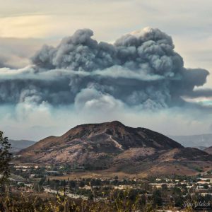
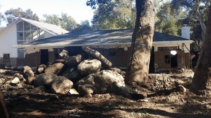
Kevin Cooper is one of just two forest biologists assigned to the nearly 2-million-acre Los Padres National Forest. The forest was first scorched by the massive Thomas Fire, then scoured in subsequent rains. “After that fire, on the steeper slopes above the coastline, entire old trees were lifted out by their roots and delivered to the ocean. Huge shifts of habitat will occur due to scouring by the debris flows,” said Cooper.
It’s clear to Cooper that Forest Service biologists need to collect data electronically, and they are currently exploring the different options. “Once forest recovery money becomes available, we look at the issues of location and recovery.”
After that fire, on the steeper slopes above the coastline, entire old trees were lifted out by their roots and delivered to the ocean. Huge shifts of habitat will occur due to scouring by the debris flows.
“Our window for forest recovery work can sometimes be really short so as not to disturb protected birds.” Data collected using migratory and nesting bird survey protocols can also provide indicators of overall ecosystem health. Cooper noted that “most endangered avian species are riparian and when a whole block is taken out, especially riparian, migratory patterns are disrupted.” The Thomas Fire roared across two counties. Cloud-based data is easily cross-referenced and shared between regions to quickly paint a comprehensive picture.

Gathering Data to Accelerate Post-Fire Recovery
Ed Orre, Cal Fire Chief in Morgan Hill, CA, believes post-fire tasks, such as culvert assessments, road repair logs, fire break assessments and cultural resource management could certainly benefit from a robust electronic survey platform like Wildnote.
Wildnote focuses on industry-relevant development of features for its field data collection app. This iterative process involves communication with agencies, field experts and—perhaps most importantly—those who use the mobile data collection app in the field. Wildnote have found that cooperative development via pilot projects allows them to address unanticipated problems. It also reveals new design opportunities which keep the Wildnote app at the forefront of mobile data collection software.
 Boulders, mud and listing trees remain 2 months after the destructive Montecito CA mudslide
threatened and endangered species, environmental planning, fire assessment, field data collection app, agency reports, GIS mapping


-1.jpg?width=250&name=wn-bICF%20Fieldwork-2%20(1)-1.jpg)
